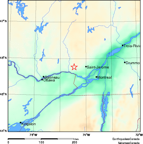
Earthquake Details (2009-07-06)
Monday July 06, 2009
| Local Time: | 07:33:00 EDT |
|---|---|
| Magnitude: | 2.4 MN |
| Latitude: | 45.77 North |
| Longitude: | 74.46 West |
| Depth: | 18.00 km |
| UT Date and Time: |
2009/07/06 11:33:00 UT |
Did you feel it?
Comments:
- 11 km N from Brownsburg-Chatham, QC. Felt.
- WESTERN QUEBEC SEISMIC ZONE.
Approximate Location of Earthquake: