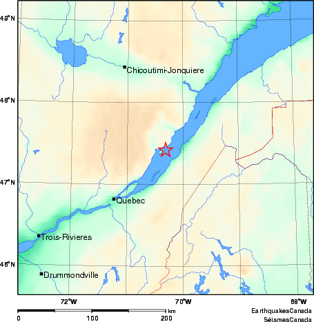
Earthquake Details (2010-08-11)
Wednesday August 11, 2010
| Local Time: | 09:03:21 EDT |
|---|---|
| Magnitude: | 2.5 MN |
| Latitude: | 47.42 North |
| Longitude: | 70.31 West |
| Depth: | 12.91 km |
| UT Date and Time: |
2010/08/11 13:03:21 UT |
Did you feel it?
Comments:
- 15 km E from Baie-Saint-Paul, QC, Felt
- CHARLEVOIX SEISMIC ZONE, QC.
Approximate Location of Earthquake: