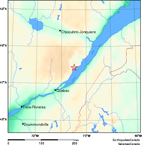
Earthquake Details (2010-10-28)
Thursday October 28, 2010
| Local Time: | 19:06:09 EDT |
|---|---|
| Magnitude: | 3.0 MN |
| Latitude: | 47.43 North |
| Longitude: | 70.48 West |
| Depth: | 7.88 km |
| UT Date and Time: |
2010/10/28 23:06:09 UT |
Did you feel it?
Comments:
- CHARLEVOIX SEISMIC ZONE, QC. Felt
- 3 km SE from Baie-Saint-Paul, QC
- Felt in Saint-Joseph-de-la-Rive, Charlevoix, QC
Approximate Location of Earthquake: