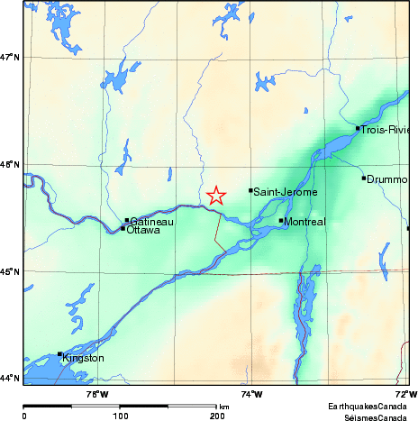
Earthquake Details (2010-02-27)
Saturday February 27, 2010
| Local Time: | 22:51:24 EST |
|---|---|
| Magnitude: | 3.9 MN |
| Latitude: | 45.73 North |
| Longitude: | 74.46 West |
| Depth: | 18.00 km |
| UT Date and Time: |
2010/02/28 03:51:24 UT |
Did you feel it?
Comments:
- 6 km NW from Brownsburg-Chatham, QC. Felt.
Approximate Location of Earthquake: