Earthquake Early Warning - Blog
2023-08-04: Camosun College co-op students help NRCan in the field
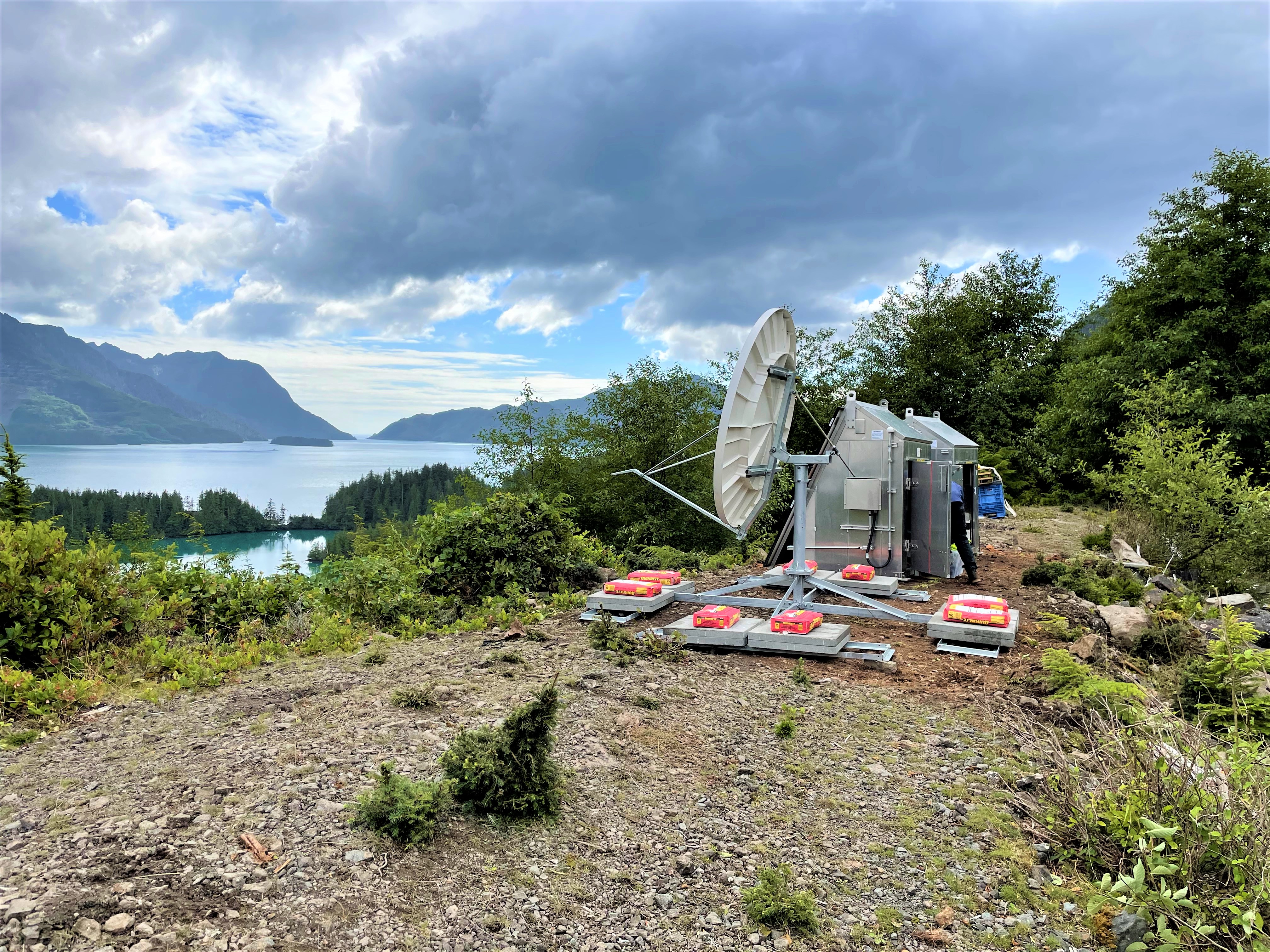
Camosun College students, Aaron Huinink and Tella Osler, recently returned from two weeks with NRCan's field crew on Haida Gwaii. The crew were installing several Earthquake Early Warning stations on the archipelago. Included in the crew's activities was the installation of complex infrastructure at a challenging site in Tasu Sound, shown above. Due to the remote nature of the site, the station is powered by solar panels, with back–up batteries, and data are sent to NRCan data centres via satellite.
2023-07-14: Less than one year to EEW
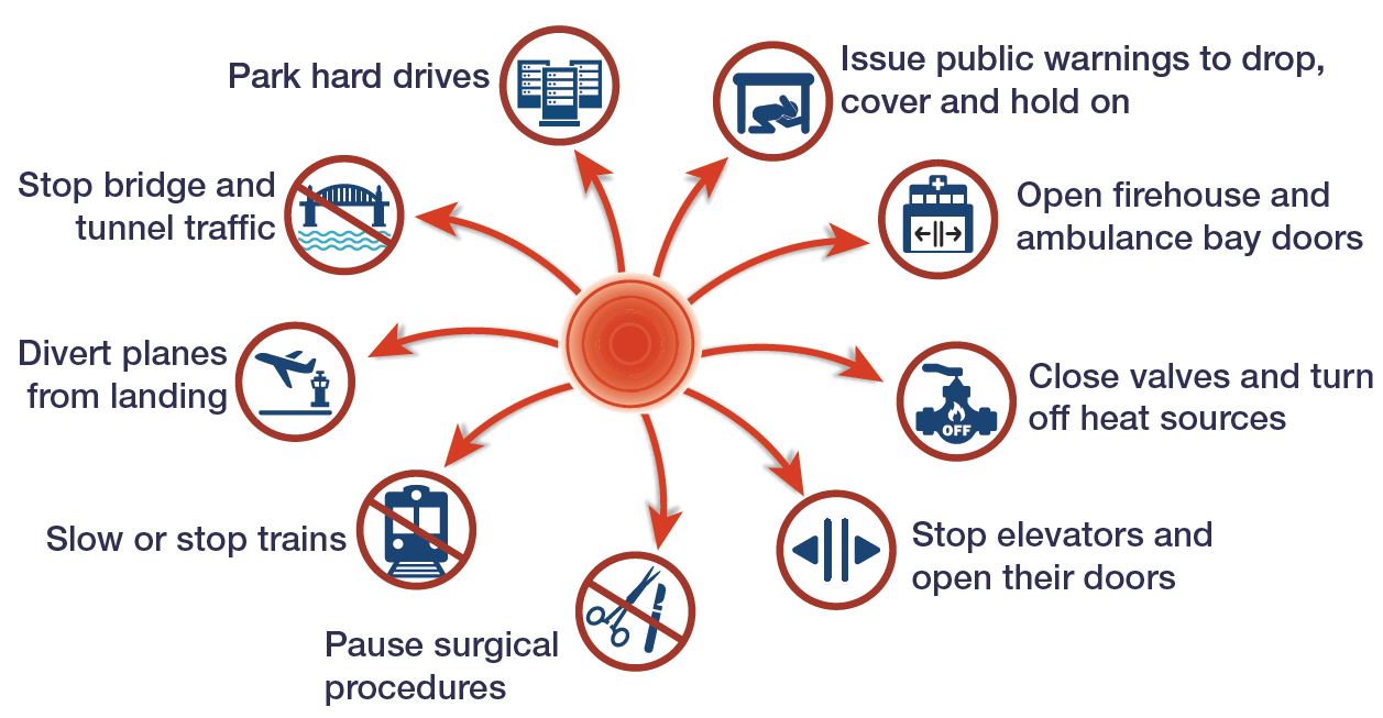
NRCan is now in the final year of development for the Earthquake Early Warning (EEW) System. Next spring, the EEW system will be on-line and able to send alerts to people, critical infrastructure operators (such as rail, energy, utilities, health, emergency response, and government), and industry. These EEW messages will announce that an earthquake has just been detected and strong shaking is imminent, providing people and systems valuable seconds to take protective actions. People will usually Drop, Cover, and Hold on (see ShakeOutBC for more information). Facilities that have automated EEW devices installed will be able to trigger safety measures, such as sound alarms, open doors, close valves, and secure machinery. These responses can reduce the impact of major earthquakes, including injuries, and help organizations return to normal operations more quickly.
2023-07-03: NRCan's EEW data centre processes its first earthquake
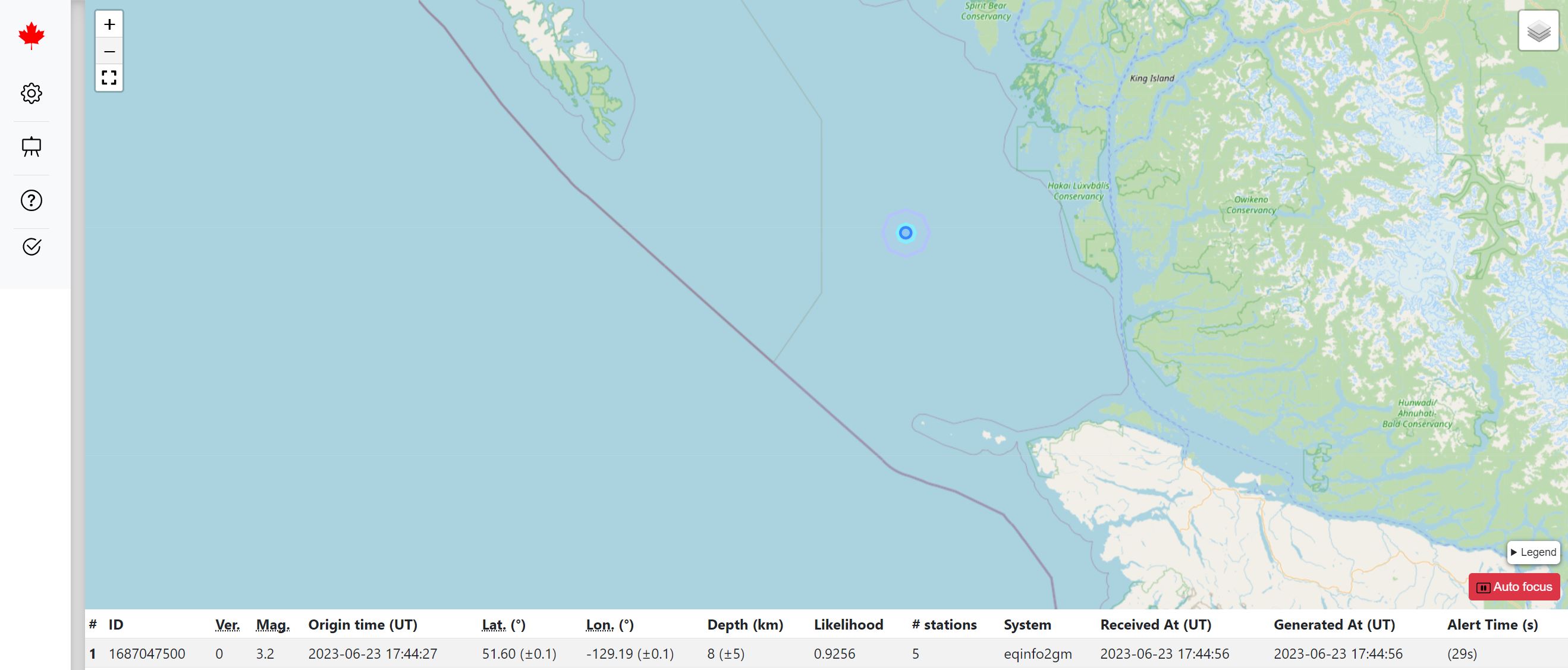
A datacentre near Ottawa, established for Natural Resources Canada's Earthquake Early Warning (EEW) system, is currently running in “test” mode while the remainder of the EEW system is being completed. The datacentre recently processed its first earthquake. The earthquake, which occurred on 18th June under the waters between Haida Gwaii and Vancouver Island, was relatively minor, at magnitude 3.2. As a result, the ground motions on land would have been too small to result in an alert.
Once the EEW system is launched in 2024, however, larger earthquakes with the potential to cause damage or injuries, will result in the data centre transmitting EEW alerts. These will be sent to automated systems, to trigger protective actions, and to the National Public Alerting System, to alert the public that strong shaking is imminent and they should protect themselves, usually to “drop, cover, and hold on”.
2023-06-30: NRCan at Earthquake Engineering conference

Natural Resources Canada (NRCan) scientists have been active at this week's joint Canadian and Pacific Conferences on Earthquake Engineering in Vancouver. This international conference seeks to develop a society that is more resilient in the face of earthquake threats. The technical programme explored advances in several fields, including structural and geotechnical earthquake engineering, seismology, earthquake early warning (EEW) and social science related to earthquakes.
Michal Kolaj presented at the “Topics in Performance-Based Seismic Design of Bridges” pre-conference workshop and gave several presentations, on seismic hazard for the National Building Code and on the national EEW system. John Cassidy served on the Conference Organising Committee, the Bridge Workshop Organising Committee, chaired two sessions, and presented on monitoring earthquakes' strong motion. Tiegan Hobbs presented on assessing earthquake risk across Canada. In addition, Alison Bird and Megumi Patchett co-hosted a booth, providing the numerous attendees with opportunities to discuss earthquakes, EEW, and the Risk Profiler web tool.
2023-06-26: Field crew installs EEW equipment and conducts maintenance at remote seismic stations
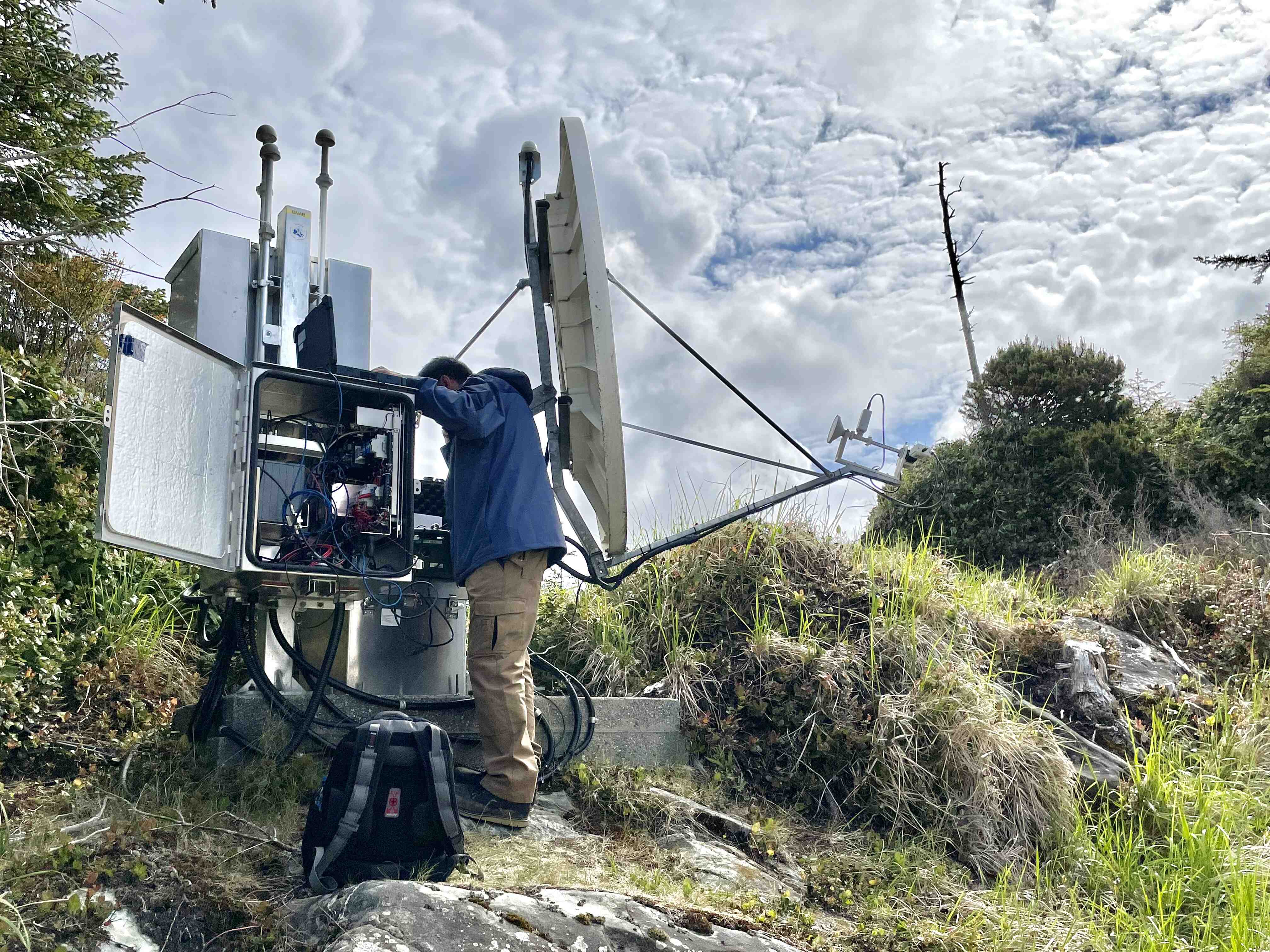

NRCan's Lisa Nykolaishen and Mingzhou Li have been visiting seismic stations in BC's North Coast region where they are installing new Earthquake Early Warning (EEW) stations, and conducting routine maintenance of the monitoring equipment. Some stations are located in remote, challenging terrains which require access by helicopter. The field teams work hard, but are rewarded with beautiful landscapes across Canada.
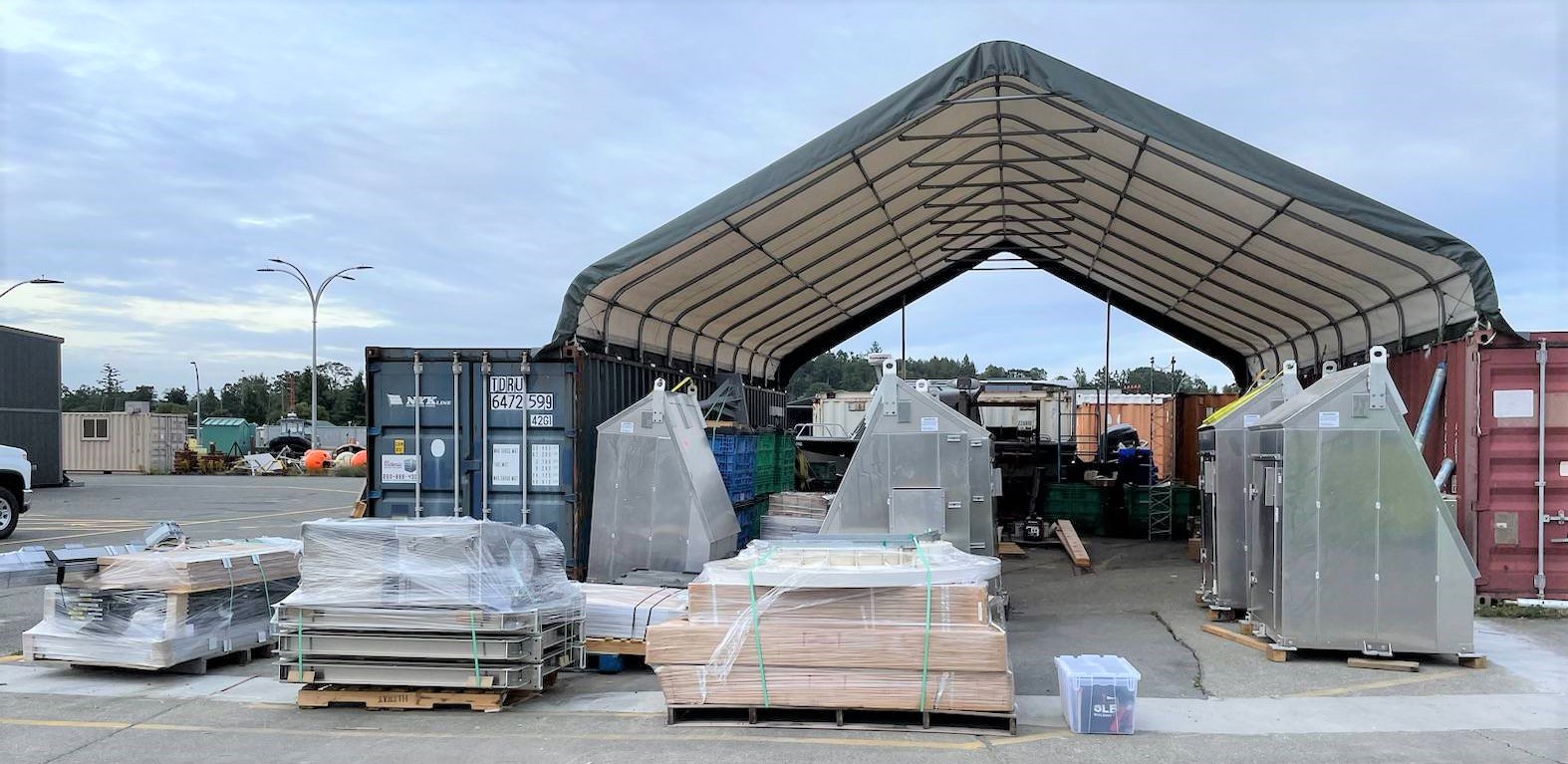
The NRCan field team has also been busy preparing EEW sensor station equipment over the past few months, for remote locations on Haida Gwaii in northern BC. The over 9,000 kg of gear will be sent via truck, ferry, helicopter and boat to these locations, where the team will install the equipment this summer.
2023-04-21: EEW session at Seismological Society of America conference

This week NRCan seismologists, Alison Bird and Claire Perry, co-hosted a session on Earthquake Early Warning (EEW) at the Seismological Society of America conference. Ten speakers presented on EEW programmes in Canada, the United States, Mexico, and Switzerland, and 14 posters showcased EEW systems and methods from around the world. Alison presented on the technical and public engagement activities for NRCan's EEW programme, and Claire presented on new research to enhance the EEW system.
NRCan earthquake researcher, Alison Bent, convened sessions on Seismic Data Collections and on Monitoring Climate Change with Seismology, and presented three posters. There were also other valuable sessions and discussions covering a wide range of earthquake-related topics, including earthquake hazard, active faults, methods for monitoring and evaluating earthquakes, modelling techniques, and associated hazards (such as tsunami).
2023-04-03: Earthquake Early Warning Data Centres

The earthquake early warning system reached a milestone recently, with the first of two data centres being established for the EEW program. The new data centre consists of 14 virtual computers, data storage, and networking to allow acquisition of data from up to 600 EEW sensor stations. The data will be transmitted from the stations to the data centres via various means of communication (Internet, cellular, satellite, and radio). Information will also be exchanged with similar data centres in the United States, to ensure both countries' EEW systems work optimally for earthquakes close to the border.
NRCan IT specialists are now working to install and configure software, enable the flow of data from the EEW stations, and collaborate with partners to ensure the open availability of data from this project. Additionally, NRCan is working on the optimal design of a second data centre which will provide redundancy for the EEW system. The data centre will issue EEW alerts to people and technical systems in Canada.
2023-03-27: Sharing Earthquake and Earthquake Early Warning information with First Nation communities in BC
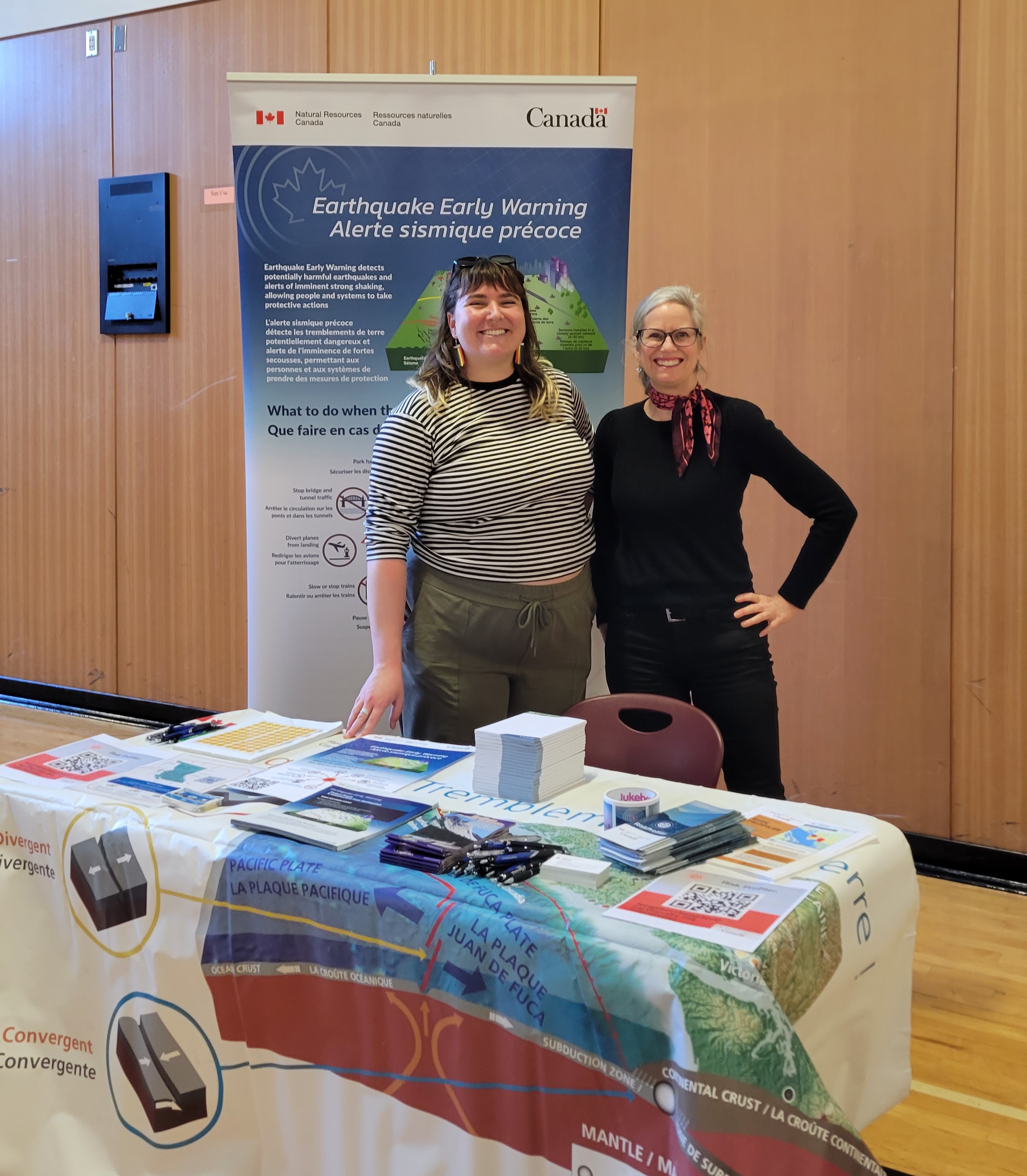
Last week NRCan scientists participated in a British Columbia Region Comprehensive Community Planning worshop at Stz'uminus First Nation on Vancouver Island. It was attended by members of First Nation communities throughout the province, including coordinators, planners, administrators, leaders, and youth. NRCan hosted a booth to share information about earthquakes in BC, the Earthquake Early Warning System, and the new Risk Profiler web-tool. Included in the workshop sessions, were engaging discussions on how to mitigate risks, prepare for emergencies, and respond to various hazard events, including earthquakes.
2023-02-21: Learning from global earthquakes: Christchurch 2011
Canada suffered a number of strong, damaging earthquakes in the first half of the 20th century, but has experienced few strong events since. In order to learn about how earthquakes are likely to impact our towns and cities in these modern times, we look to major earthquakes around the world.
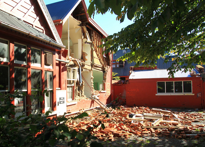
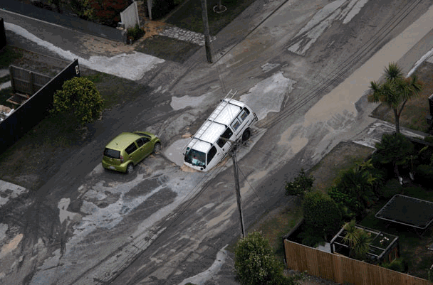
The M6.3 earthquake in Christchurch, New Zealand which occurred 12 years ago (photos, above, by Ross Becker and Brett Phibbs), for example, is a reliable proxy for what might happen to Victoria in a similar shallow, crustal earthquake very close to the city. The cities share similar geographies, populations, building codes, industries, and other characteristics. By examining the impacts of the Darfield event, we can seek ways to reduce or even eliminate similar impacts in Victoria and other cities in Canada.
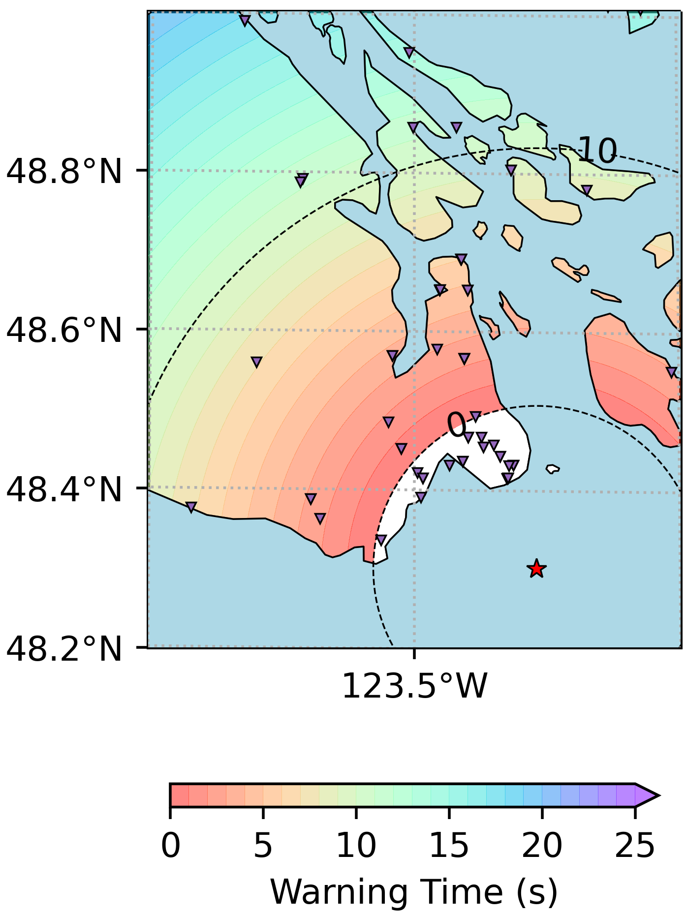
We have calculated how the Earthquake Early Warning system we are developing would behave in such an event in Victoria. Unfortunately, this is one of the rare cases of a shallow earthquake very close to a populated centre, where alerts would have very short warning times, or even arrive too late in neighbourhoods close to the epicentre (in what is known as a Late Alert Zone
, white area on the map, above). In other words, it is a good example of why it is necessary to have multiple resiliency measures in place: an EEW system, a seismically resistant building code, and public education on how to respond to earthquake shaking and EEW alerts.